Sunday, July 3, 2016

Sheep Mountain 8274', Pasayten Wilderness

Up until yesterday I'd never had that perfect Pasayten trip (snow in May, snow in June, record-setting heat in June, downpour in October, etc.). I remember planning the trip with Graham and Paul in 2014 and Graham remarking, "It's the Pasayten...something always happens."

With those experiences in mind, I planned to backpack out to Sheep Mountain and then stay in Whistler Basin, hiking out the following morning. I figured there would be hundreds of blowdowns and the other usual issues that create longer-than-planned trips. Unfortunately, things went a little too well and I summited Sheep in 6:35 from the car, arriving in Whistler Basin just before 5pm. With five hours of daylight left I had no idea what to do, so I just hiked out, finishing at 9:45pm, about two minutes shy of needing my headlamp. After being gone all last weekend, a certain kiddo was very happy to have me home earlier than planned.

Hiking 40 miles with a full backpacking set up that went unused felt pretty lame, but the day was truly amazing and I think this is my new favorite area in the Pasayten...

  • Billy Goat trail: cleared to Drake Creek.
  • Larch Creek - Larch Pass: one large microburst of trees passable off trail; ~100 (?) blowdowns w/the majority being step overs, some crawl unders and climb overs.
  • Northern trails (McCall Gulch, Whistler Basin, Peeve Pass): some patchy snow though none present any real difficulties; everything in great shape and very lush. 
Shout out to Gary and Otto; it was very nice chatting with you and I hope you had a good time on the rest of your trip!


Training weight...ugh...
Weekly dose of Wilderness
Many Trails Peak over Diamond Creek and Lost River
Go high for the first group and low for the second, which is a quite big grouping
Larch Creek drainage with Larch Pass

East Fork Pasayten River drainage; beetle kill?
McCall Gulch basin with Two Point Mountain
The northern Pasayten is in bloom
Corral Lake
First full view of Sheep Mountain, from above the Timber Wolf Creek drainage
Looking back toward the pass above McCall Gulch (where the previous photo was taken from)
South slopes of Sheep Mountain in bloom
South side of Sheep Mountain, from 7300'
Buck and doe on Sheep Mountain
Two bucks on Sheep Mountain
Upper slopes of Sheep Mountain, ~200' of easy talus
Looking east from Sheep Mountain: Cathedral Peak and Pass, Amphitheater Mountain, Windy Peak, Remmel Mountain
South (left) to west, from Sheep Mountain
Ramon Lakes on the north side of Sheep Mountain
Jack Mountain (r), Ptarmigan Peak (l)
Sheep Lake and the eastern Pasayten

Bear tracks at Peeve Pass
Sand Ridge, dividing Timber Wolf Creek and Mayo / Whistler Creek drainages
Whistler Basin
Whistler Basin and Ashnola Mountain
Trail to Whistler Pass
Glacier Lily
Whistler Basin
McCall Gulch basin, Larch Pass from Whistler Pass
Looking back at Whistler Pass over McCall Gulch
Setting sun from Billy Goat Pass, looking north
Just about back to the car; looking south from the Billy Goat Pass trail


Monday, June 27, 2016

Chelan-Sawtooth Traverse

Almost more than planning my own trips, I love receiving an invitation for an interesting adventure. The keywords from Patrick's email (all the way back in April) were easy bait: point-to-point, 70 miles, Sawtooth crest. Done. 

After Angel's Staircase in 2013 I've been loosely promising myself every summer that I was going to go back and do the Chelan Summit trail. The logistics with the boat, horrible car shuttle and essentially needing three days when factoring travel in kept me from ever seriously planning to do it. Patrick's invite and determination provided the motivation and his plan to just run the 30 miles of forest service roads along the crest south of the Chelan Summit trail eliminated the car shuttle and pieced together a more complete traverse of the range.

We took the Lady Express boat to Stehekin, followed the Chelan Summit Trail for its entirety and then stayed on top of the ridge on roads 8200 and 8020 until descending to Echo Valley, just northwest of Chelan where the paved road begins, hitching a ride for the highway miles in the back of a pickup that had $300 worth of Costco picnic supplies shifting under us. 

Big thanks to Patrick for planning the trip and inviting me along. It was much harder than expected, compounded by me being sick for about four hours (from elevation, I think). We were on a great pace through 27 miles until that happened and it slowed us down over the last ten miles of the Summit Trail until we made up time along the roads.
  • Chelan Summit Trail: 300+ blowdowns with nearly half of them in the final miles on the South Navarre portion, which also is very brushy. Plentiful water throughout (except on the climb from Stehekin to Purple Pass). Snow fields, but mostly patches, remain on almost every north-facing pass or basin, though none were an issue and route finding was straightforward. 
  • Road 8200-8020 Cooper Mountain Road: regular water from creeks and springs until Black Canyon Spring, then no real source down to Echo Valley.
Over the 70 miles we did not see a single person...

~70 miles and 16,800' gain
On the Lady Express
On the Lady Express, looking back at the Chelan Mountains (west side of lake)
Docking in Stehekin
Stehekin Landing; Patrick's photo
Instant vertical relief, climbing up to Purple Pass 
Pano from Purple Pass
One of few (or the only?) continuous on-trail climbs in Washington State that gains over a vertical mile (~5800'+)
At Purple Pass
Follow the arrow for 31 miles
Lake Juanita
Chelan-Sawtooth Wilderness Boundary; Patrick's photo
Chelan-Sawtooth Wilderness Boundary
Big-picture directions
South and North Spectacle Butte, Maude, Seven Fingered Jack, Fernow
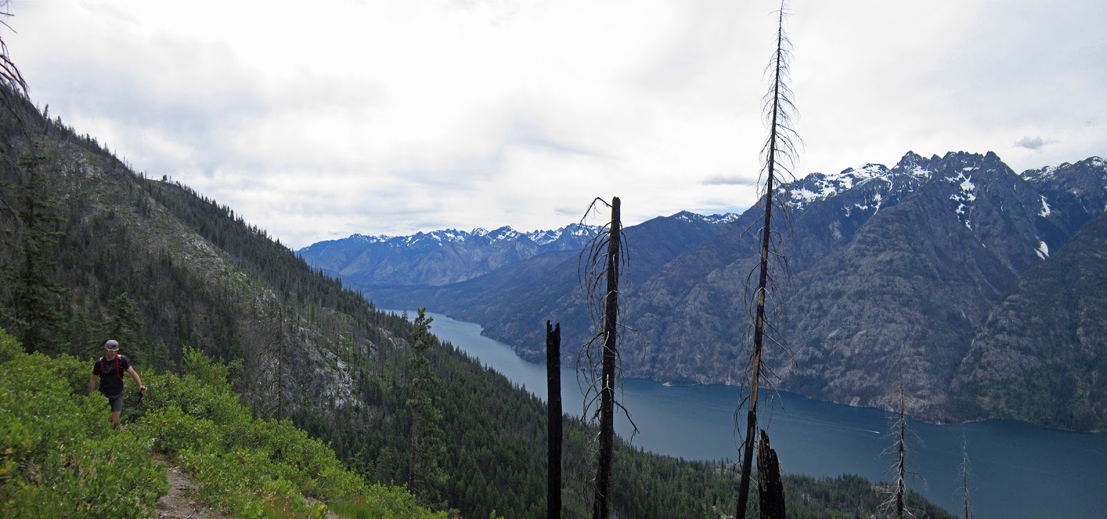
Looking west over the Fish Creek drainage; Railroad Creek is the prominent drainage center-left across Lake Chelan
Chelan Summit trail across East Fork Fish Creek, with Oval, Gray, Courtney and Star
Chelan Summit trail entering Horseshoe Basin
Snow on the climb to the pass separating Fish and Prince Creek drainages, with Courtney Peak
Prime larch country
Trying to keep dry feet; Patrick's photo
Middle Fork Prince Creek drainage with Martin Peak (l), Old Maid Mountain (r); Angels Staircase's west side center-left at back (below the black triangle shadow)
Patrick's photo

Evening light on Emerald and Cardinal in the northern Chelan Range
Final pass; Patrick's photo
Climbing up to the last major pass, separating East Fork Prince Creek and Safety Harbor creek; also the junction for South Navarre and Summer Blossom trails
Near the pass, looking back across the East and Middle Fork Prince Creek drainages
Chelan Summit Trail trailhead at South Navarre
31 miles < 40 miles
Patrick sports the space blanket skirt: warm legs while napping and when starting out after said nap
As far as running FS roads goes, this one is pretty nice as it stays on the ridge, has good views and tons of flowers
Final miles down to Echo Valley, over the foreground ridge; Patrick's photo
Done... Patrick's photo