Great Basin road trip part three of three: October 21, 2015
“The area around you is of rugged
beauty, but fragile in nature…”
-Ruby
Crest Trail sign in Lamoille Canyon
---
After bailing out of our second day in Great Basin National Park we headed straight to McDonald's in Ely ("they only have charging outlets in the kids' play area," Ben advises. "I learned that last time I was here.") and then charged on another four hours through the Ruby Mountains to set up a car shuttle before crashing in Elko.
"Look at it in terrain view," Ben told me.
Sure enough, a swooping sickle of a canyon that can't look any more congruently U-shaped; the unmistakable work of ice and time has turned Lamoille Canyon into a destination in and of itself. Northeast Nevada, today, hardly seems like the place to be awed by glaciology, but it's just as apparent as the best North Cascades mountain carvings. The entire western side of the Ruby is the same...
---
The
Ruby Crest Trail runs approximately 37 miles from Road's End in Lamoille Canyon (8800') to Harrison Pass (7300'), with the majority of the trail remaining within the
Ruby Mountains Wilderness at an average elevation of 9200'. It feels like a cross between the Pasayten and the Stuart Range/Enchantments; a mix of gentle-sloped summits at nearly 11,000', contrasted with craggy outcroppings and cliffs on sharper mountains with an abundance of relatively-large alpine lakes and streams.
It was the final adventure day on our road trip and great to be running again after four days of backpacking. Though running for my hypoxic body was definitely not what I'm accustomed to in Washington.
We had spectacular weather on a stellar route; could not have asked for a better ending to our trip.
 |
| Lamoille Canyon from a mile up the trail |
 |
| Lamoille Canyon with Snow Lake Peak (left), from just below Liberty Pass |
 |
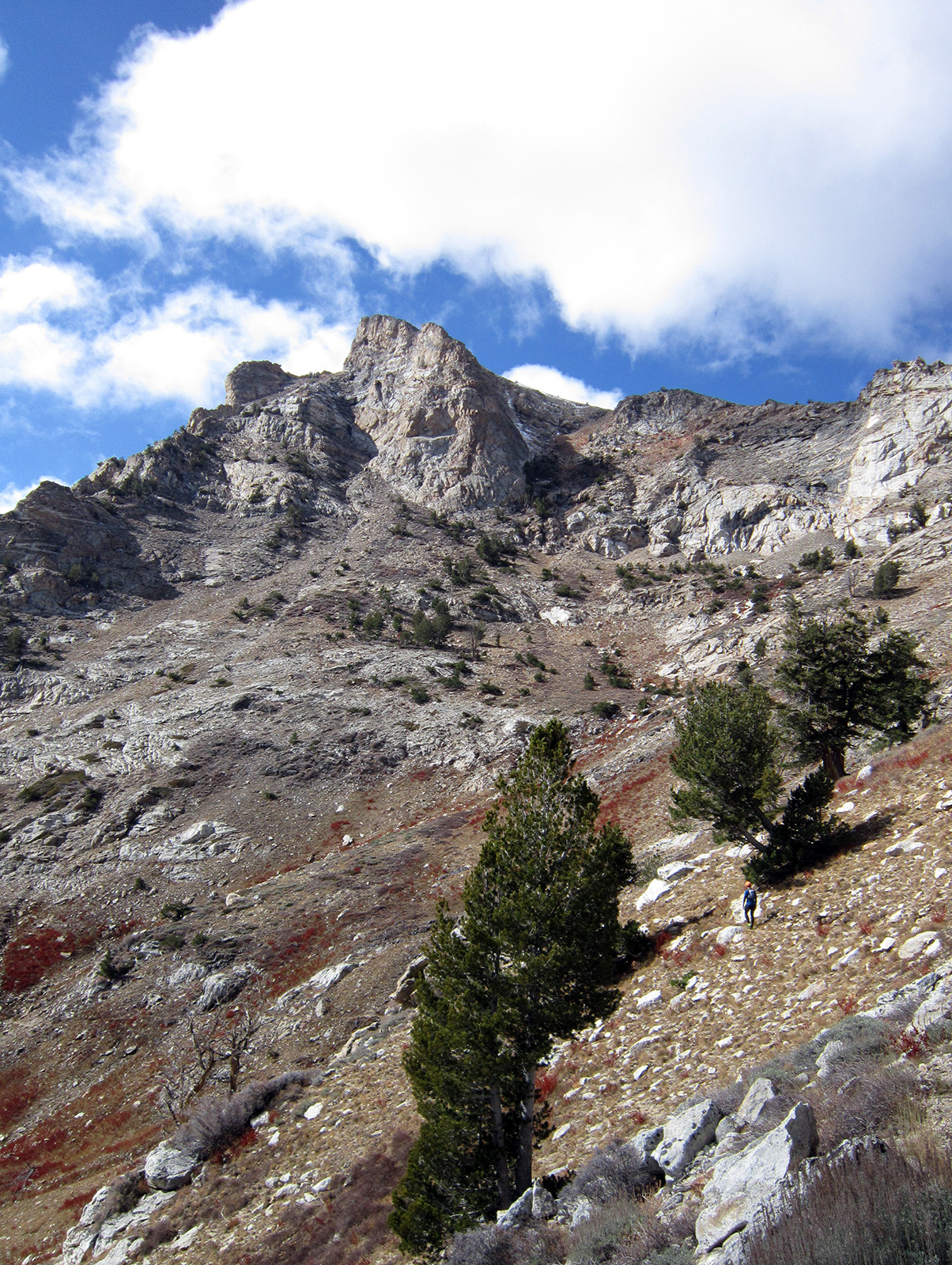
| "Yeah man, this is awesome" |
 |
| Ruby Mountains Wilderness boundary at Liberty Pass |
 |
| Descending from Liberty Pass; Liberty Lake and Lake Peak |
 |
| Castle Lake and Lake Peak |
 |
| Climbing up Wines Peak, northern Ruby Mountains where we started beyond |
 |
| Wines Peak north slope; Ben's photo |
 |
| Marshy areas in the Ruby Valley, from near Wines Peak's summit |
 |
| Wines Peak summit 10,893' |
 |
| Leaving the summit of Wines Peak, looking east |
 |
| Climbing up over the next unnamed 10,700'+ point |
 |
| Punchy snow running along the Ruby Crest; Ben's photo |
 |
| Ben descending the same slope |
 |
| Another glacial carving: Long Canyon; King Peak back right |
 |
| Pretty superb country |
 |
| Contouring around King Peak on the east side of the Ruby Crest |
 |
| Upper Overland Lake |
 |
| Overland Lakes |
 |
| Ben's photo |
 |
| Switching over to the west side of the crest past Overland Lakes |
 |
| Ben, with Tipton Peak and Green Mountain |
 |
| Moon rise over Tipton Peak's south ridge, above South Fork Smith Creek |
 |
| Rounding Green Mountain and looking down on Harrison Pass in the mid ground, below Pearl Peak |
 |
| Sunset as we finish up the last three miles... |


Great country! Was there mid September, after I had to cancel my Sierra trip, because of the smoke and fires. This was awesome ... turned around a little before Overland Lake, because of my water situation. I would totally go back again.
ReplyDeleteToo bad about the Sierras, but awesome you also got to experience the Rubys! Did you start at Lamoille in the north? That section to Overland is by far the highlight anyway! There are a lot of cool ranges in NV worth investigating :)
Delete