Monday, August 29, 2016

Rainbow Pass-McAlester Pass lollipop, North Cascades

Most of my trips southbound on the PCT from Rainy Pass have been early season and the Bridge Creek ford has been waist-deep whitewater. A cooler, late-summer day was perfect to avoid both the heat and the fording issue present earlier in the year. Beyond being absurdly dusty, the trails have been maintained to a near-comical level (read Mt. Si, new Mailbox trail). Definitely makes for quick and easy travel! Thanks to Faron for making the long drive to 'Murica.

Bridge Creek ford: barely over the ankle (note high water on the bank behind Faron)
Looking back down the South Fork Bridge Creek drainage, with a brief rain shower
Rainbow Lake from Rainbow Pass; Tupshin and Devore peaks
The upper tarns at Rainbow Lake
Tupshin Peak, Devore Peak
Descending to Rainbow Lake
Rainbow Lake and the eastern ridge of McGregor Mountain
Climbing up Rainbow Creek to McAlester Pass
McAlester Mountain
McAlester Pass is just a huge meadow

Sunday, August 14, 2016

Easy Peak 6615', North Cascades National Park

Most people only visit Easy Peak as a gateway to the Northern Pickets: an inconsequential bump and potential high camp before heading into the real mountains. For me, that's a perfect destination: long on-trail approach, climbers trail and light XC travel with wonderful views, trail back out.

  • The Copper Ridge Loop is very busy and as such, the Hannegan and Chilliwack River trails have been fully maintained. 
  • Chilliwack ford was barely shin deep and the Easy Ridge climbers trail is as advertised. First tarns upon reaching the ridge are all dry, but the ones midway up still have 6-8" of murkiness. 


Ruth from the Hannegan Pass trail; everyone takes this photo...
Chilliwack crossing for the climbers trail; barely reaching my shin
Midway up Easy Ridge with Easy Peak at right; Challenger, Whatcom, Whatcom Pass
Slesse and more Canadian peaks beyond
The steeper step before Easy Peak, summit back left
Mineral Mountain and Pioneer Ridge, from midway up Easy Ridge
Pano from Easy Peak: east end of Pioneer Ridge, Mt. Crowder, southern and northern Pickets (some obscured), Challenger, Perfect Pass, Whatcom, Whatcom Pass
Southern Pickets behind Mt. Crowder
Poorly-lit Northern Pickets
Pioneer Ridge; an even more isolated part of the North Cascades
Mt. Blum
Clouds to the north (Redoubt at right) 
More interesting clouds to the west, over Mineral Mountain and Shuksan
Mox Peaks and the Col of the Wild, Spickard back left; Red Face and upper Tapto Lake in the foreground
Redoubt and Bear Mountain; Red Face in foreground
Perfect Pass, Challenger, Luna lurking beyond
Easy Peak 6615'
Tarn of dead moths (but still tasted good after filtering); Copper Ridge to the north, Copper Mountain, Slesse, Border Peaks group
ID? Looks like dried up Elephant's Head?
Shuksan: Nooksack Cirque, Nooksack Tower, Price Glacier
A group of three destroyed trees with hollowed out cores
Large cedar burl


Sunday, August 7, 2016

Elysian Fields, Mount Rainier National Park

In 1888, this name was given by Maj. E.S. Ingraham, because the delightful location and environment reminded him of a mythological region of paradise on earth. -R. Hitchman

Indeed, MRNP's Elysian Fields is a beautiful, seemingly calm area in a region torn apart by volcanism and glacial erosion. It is a fragile area, so please travel lightly... Thanks to WillisWall for his trip report for the area from 2015.

Starting from Mowich, Ben and I went to Spray Park, down to the Carbon River and up to Windy Gap, then did the Elysian Fields-Moraine Park traverse, meeting the Wonderland Trail around 5700', descended to the suspension bridge, went back up to Spray Park and returned to Mowich via the Knapsack Pass route.

~28 miles, 10,800'+ gain

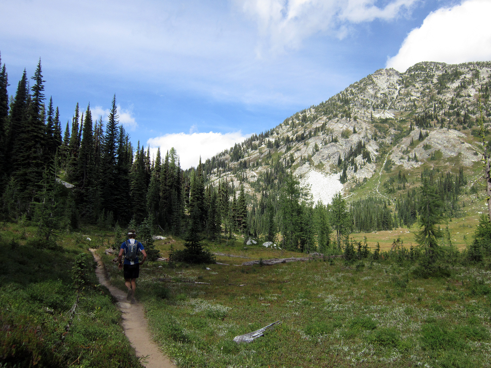
Spray Park in the morning
Ben in the beginning section of Spary Park
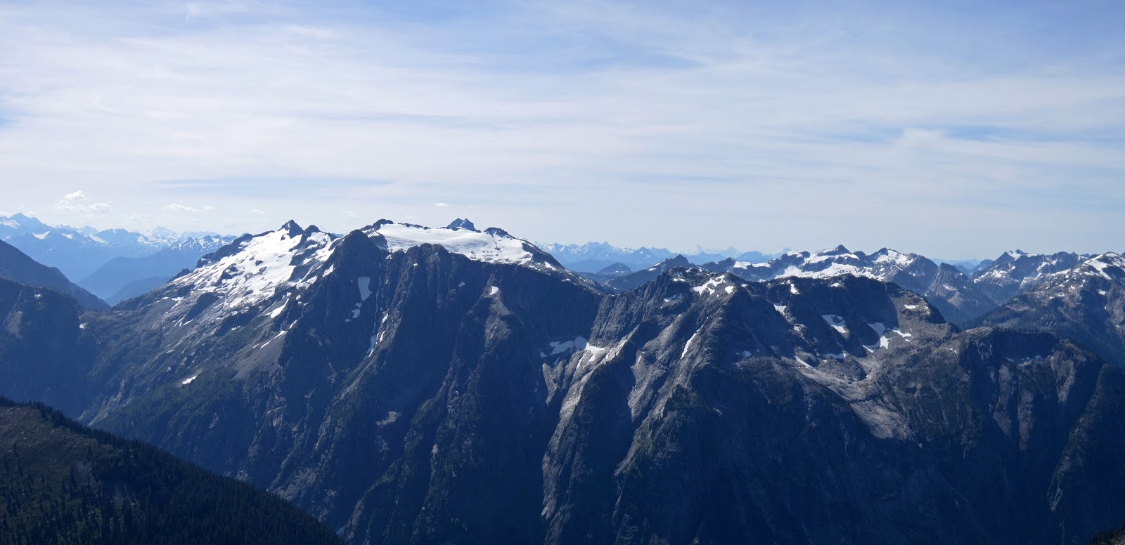
Glacier Peak and Alpine Lakes Wilderness summits
Descending the east side of Spray Park
Ben checking out some flowers in Spray Park
Looking up at the start of the traverse: Crescent Gap
Windy Gap tarn
Starting the climb up to Crescent Gap
Nearing Crescent Gap, with the west side of Windy Gap behind; Ben's photo
Windy Gap, Independence Ridge, Tyee Peak
Willis Wall and Liberty Ridge
Ben near the frog-filled stream in Elysian Fields
Elysian Fields, Crescent Gap and Crescent Mountain
Ben climbing out of Elysian Fields
Xenolith?
Elysian Fields, Crescent Mountain, Mother Mountain at left
Mini Lupine on the north end of Old Desolate
Sluiskin Mountain (summit on right tower)
North side of Rainier and Moraine Peak, from point 6,996' (Old Sesultory?) on Old Desolate
Huge falls draining the Russel Glacier into the Carbon Glacier/River
On point 6,996' of Old Desolate
Vernal Park, with Skyscraper, Berkeley and Burroughs beyond
Lower Moraine Park and Mother Mountain
Looking back up at the descent from the north side of Old Desolate into Moraine Park
Upper Moraine Park
Descent back to the Wonderland Trail
Carbon Glacier terminus
Pink Paintbrush in Spray Park in the afternoon
Goats on the way to Knapsack Pass, above Mist Park
Traversing toward Knapsack Pass
Another group of goats, east side of Fay Peak
Climbing up to Knapsack Pass; Ben's photo
Looking east from Knapsack Pass 
Looking back up at Knapsack Pass from the Mowich side