This route includes approximately 7 miles of blowdown hell through burn areas that have not and most likely will not be maintained again. However, it was the only way to make the loop work.
Route from Billy Goat Trailhead: Hidden Lakes, out and back to Ptarmigan Peak via Tatoosh Buttes (165 blowdowns), Big Hidden Lake to East Fork Pasayten, XC travel up Snowslide Creek ridge to Quartz Mountain (from Big Hidden to the XC section has 1,000+ blowdowns), Boundary Trail to Quartz Lake (camp), Sheep Mountain, Sand Ridge traverse, Ashnola Mountain, return to Billy Goat via Larch-Three Fools-Billy Goat passes.
65 miles, 17,500'+ gain
Sleeping in the parking lot Friday night we were continually awoken by a porcupine (tugging on my sleeping bag, gnawing on the out house and later my car), we saw a nice black bear on the way to Hidden Lakes, deer, various birds, gorgeous flowers and enjoyed solitude in what remains probably my favorite Wilderness area.
Thanks, Ben; a very special trip!
 |
| Crazy parking lot porcupine; Ben's photo |
 |
| Continued...Ben's photo |
 |
| Looking toward Lost Peak |
 |
| Marshes before Cougar Lake |
 |
| First Hidden Lakes |
 |
| One of the cabins near Middle Hidden Lake |
 |
| Barrow's Goldeneye family in Middle Hidden Lakes |
 |
| Heading up the Tatoosh Buttes trail |
 |
| Nearing the top, looking at Tamarack Ridge and Ptarmigan Peak |
 |
| On the way to Ptarmigan with Lago, Carru, Osceola |
 |
| South (l) to northwest from the summit of Ptarmigan |
 |
| Pickets, Baker and Shuksan over the western Pasayten |
 |
| Descending Ptarmigan with Tamarack Ridge and Tatoosh Buttes |
 |
| Ptarmigan Lake and the eastern Pasayten |
 |
| Tamarack Ridge |
 |
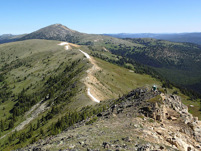
| Looking back at the route up Ptarmigan |
 |
| From Tamarack Ridge, looking at the route we would take up out of the East Fork Pasayten on Snowslide Creek ridge to Quartz Mountain; Sheep Mountain behind Quartz |
 |
| Welcome to the East Fork Pasayten River |
 |
| Standard East Fork Pasayten |
 |
| XC route up Snowslide Creek ridge; Ben's photo |
 |
| Earning blowdown merit badges |
 |
| But eventually you break out; Quartz Mountain and the Boundary Trail ahead |
 |
| Phlox was everywhere; Ben's photo |
 |
| Headed to Quartz Lake on the Boundary Trail; day 2 destination Ashnola Mountain at right |
 |
| Looking west near sunset |
 |
| Quartz Lake in the morning |
 |
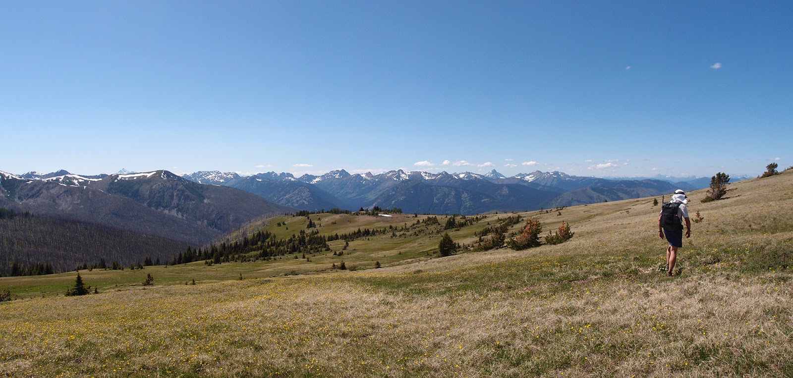
| Meadows below Peeve Pass |
 |
| Bear and ungulate prints in the meadow |
 |
| Dropping packs on the way up Sheep; Sand Ridge at center |
 |
| Climbing up Sheep; Ben's photo |
 |
| Ben climbing up Sheep |
 |
| Ramon Lakes basin from the summit of Sheep |
 |
| Sheep summit pano; Ptarmigan (at left) looks pretty far away |
 |
| Ben on the summit of Sheep |
 |
| Ptarmigan on Sheep |
 |
| Headed up to Sand Ridge; Ben's photo |
 |
| On Sand Ridge |
 |
| Sand Ridge with Sheep beyond; Ben's photo |
 |
| Sand Ridge and Ashnola Mountain over Whistler Basin |
 |
| Sand Ridge, on the way to Ashnola beyond; Ben's photo |
 |
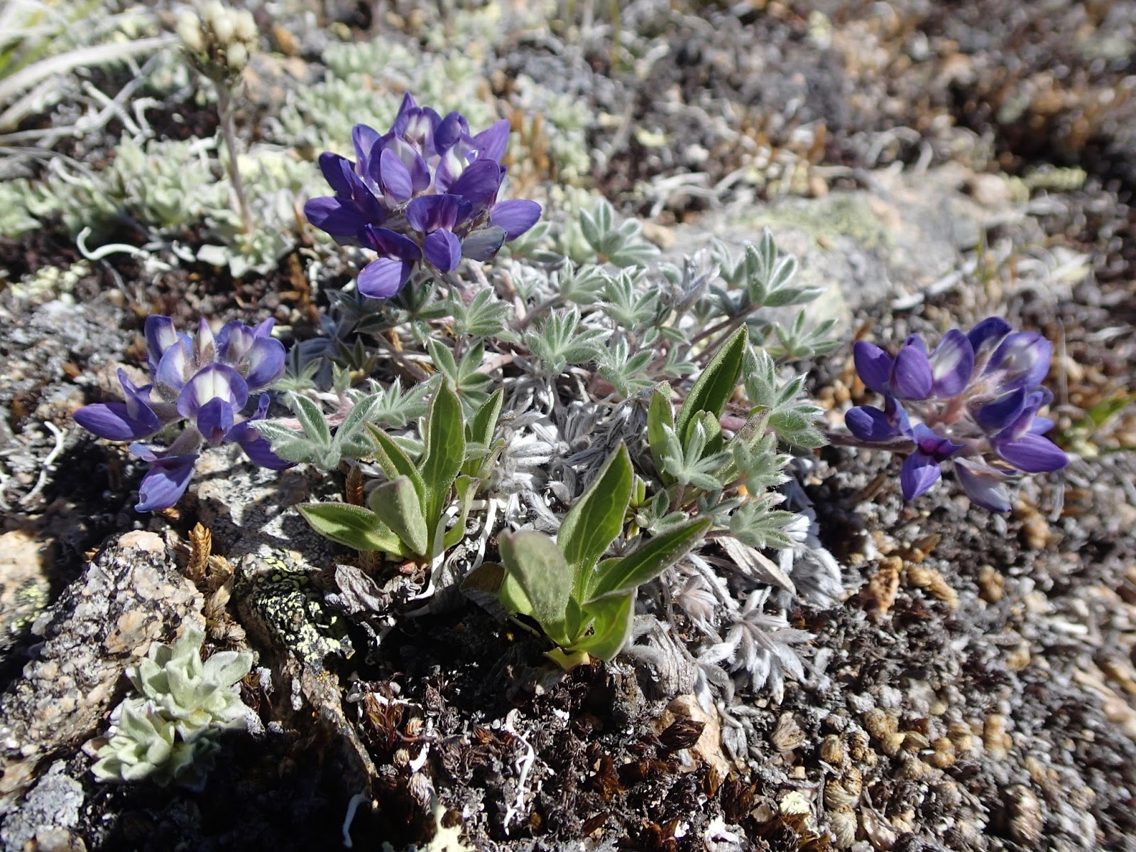
| Mini lupine on Ashnola |
 |
| Sheep, Sand Ridge and Whistler Basin from the summit of Ashnola |
 |
| Pano from Ashnola summit |
 |
| Last summit of the trip |
 |
| McCall Gulch and Larch Pass |
 |
| Three Fools Pass under the scorching east side sun |


The first 2.3m up to the pass is fine; some erosion and rockier sections.
ReplyDeleteReally nice to see. I first made just about the exact same trip in 1973. If I remember right, the cabin was an old FS cabin giving a roaming ranger a place to stay . Looks a little worse for wear than in 1973.
ReplyDeleteThe last time I saw that area was 1994.
Hate to see the burn it looks like went through.
Thanks for the memories and great pictures!