Saturday, October 26, 2013

Opal Cone, Garibaldi Park - w/Darren

More taking advantage of the fabulous weather.

Headed up to Garibaldi Park with newly-minted-dad Darren and we were out on the trail just after 7am. Headlamps only required for the first 30 minutes or so and then they were relegated to training weight.
First light hitting the Tantalus Range.
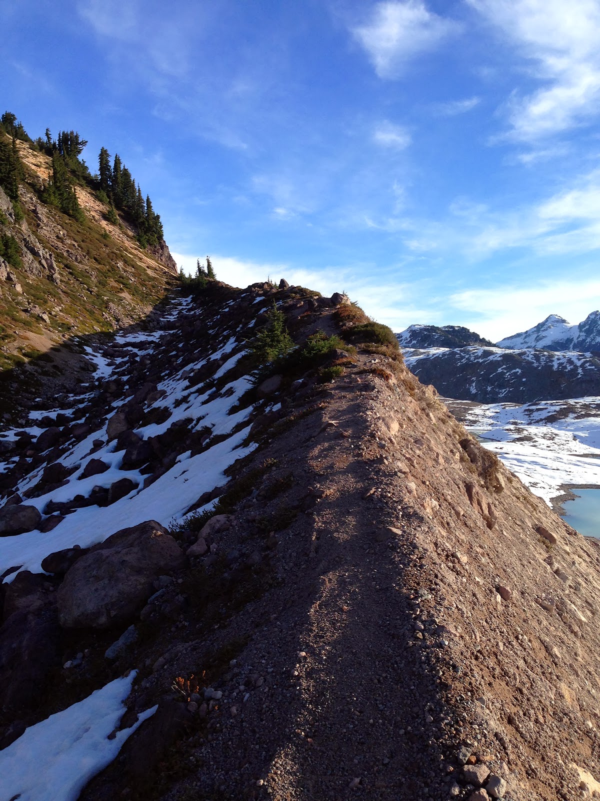
Paul Ridge in the foreground; background L-to-R: Garibaldi, Luxor-Tut, Pyramid, Mirage, Darling.
Cresting Paul Ridge.
Elfin Lakes; Opal Cone is the flat-top dome with snow on top behind the second, smaller lake.
Dropping down to Ring Creek.
Looking south down Ring Creek.
Trail up the east side of Opal Cone.
Darren gaining the crater rim of Opal. 
Opal Cone crater; the last eruption was 9,300 years ago. 
Darren on the north side of the rim.
Me.

We took the wrong way down off the cone, trundling volcanic choss as we scrambled. Added a little spice to the otherwise highway-esque trails.

Another good day in the mountains...

Sunday, October 20, 2013

Cascade Recreation Area loop

I wanted to take advantage of the great weather that's hanging around after that early fall storm and spend another full day in the mountains. Unfortunately, I couldn't find anyone to join in the "fun" (on either side of the border) so solo it was! Though, admittedly, if I'd known I was going to have the route-finding issue I had, it probably would have been better to be with someone.

I really enjoyed the trails in the Manning Park area when I was there in July and decided to head back, but this time going for a longer outing at lower elevations. The Cascade Recreation Area seemed like a good option for a long loop.

Starting from the Cascade Rec. parking lot on Crowsnest, I took the Whatcom Trail over Punch Bowl Pass and down to Paradise Meadows, then the Dewdney trail to Hope Pass, Hope Pass Trail back to Crowsnest and then the highway to where I parked.


First view of Snass SW2 from the Whatcom Trail headed toward Punch Bowl Pass.
Snow started around 5,100' going up to the pass, but was patchy and disappeared as the trail gets out of the trees and onto the open alpine area just below the pass.

Looking back south from just below the pass. Silvertip back right, Marmot in front, Rahm, Custer and Redoubt back center (I think).
Looking north to Punch Bowl Lake and the Cascade Rec. Area from the pass. Snow was crunchy and icy and continued down past the lake for a bit. One track of footprints from a trip I saw on the ClubTread forum. The lake had ice on about half of it. Warburton Peak back left.
Near Paradise Meadows on the Dewdney Trail.
Not that my feet were dry before this, but still a dumb choice :)
Tulameen River crossing.
Holding Creek crossing; ice cold and it'll soak you all the way up to your manpris! 
More nice meadows.
Snow on Dewdney heading east toward the FS road. 
Slogging along the FS road going to the Hope Pass area.
Looking southwest from the area around Kettle Mountain. 
Along most of the "ridge" of the FS road there is 6-12" of snow. The road is mostly compact snow-ice from trucks, but since it didn't appear that any hikers had been up here I couldn't find the shortcut turn off from Skaist down to the Hope Pass-Nicomen Lake trail junction. Instead I continued down the road to the Hope Pass Trail intersection, then had a snowy climb back up to Hope Pass. I didn't see any human/horse prints, so I guess no one has been up there for the last couple of weeks.
My lonely footprints from the FS road to Hope Pass-Nicomen junction. Trail was easy to follow, though.
Hope Pass-Nicomen Lake trails junction.
By this point I'd probably spent 6-8 miles in the snow and was looking forward to getting back on dirt.
Descending the Hope Pass Trail. 
Quite a bit of mud in the snow-to-dirt transition areas.
Even though almost all of the trails I was on are stock trails, they really feel like backcountry singletrack (at least this time of year). In the 38 miles of trail (excluding Crowsnest) I covered yesterday I saw ONE PERSON: a guy with two horses at the Tulameen Ranger cabin, and that was it. Given the weather, that surprised me.

All the trails were in good shape too. Some blowdown on Whatcom and quite a few moderately-brushy areas on the middle portion of the Hope Pass Trail, but otherwise everything was really nice.

I had originally planned on taking the Skagit Bluffs Trail back to the parking area, but since the snow had slowed me down and I had to take the long way around Hope Pass I was much later than expected and chose Crowsnest as a quicker alternative. It's not the safer option, probably, but it was getting late.

Overall a good day.

Sunday, October 13, 2013

Columbia River Gorge loop

A nice 50k+ outing with Paul Turner off of the gorge in northern Oregon. Cool drizzle to start the day, some wind and mixed rain and snow up on top of Chinidere Mountain above Wahtum Lake and then a moderate afternoon cruising back down the Pacific Crest Trail and over the Gorge Connector trail.
Starting up Eagle Creek.
Running behind Tunnel Falls.
Upper Eagle Creek trail near Wahtum Lake.
In the rain/snow on top of Chinidere Mountain, 4,700'.
PCT heading north from Wahtum Lake/Chinidere Mtn. toward Cascade Locks.
My GPS cut out a lot coming up through the canyon; trail maps and guides have the loop at ~32.5 miles.


Thanks Paul! 

Sunday, October 6, 2013

A good reminder

After getting up to the First Pump on Mt. Seymour, I realized I only had two gels to go the last thirteen miles back to Lynn Headwaters. Ouch. For some reason I just didn't think about how much food to take with me; 700 calories was not enough...

It was a pretty brutal return trip down Seymour (via Perimeter then Old Buck) and then back to Lynn Headwaters (Bridle, Good Samaritan, BP, Lillooet road, Lynn Connector).

And now, looking outside at a beautiful, clear-blue sky, I should have been fair-weather-minded and gone out today!

Seymour First Pump summit yesterday at11am.
GPS cut out a lot in the first half, but the second half was good and came in at 13 miles, so should have been 26-ish total.


Sunday, September 29, 2013

September 29, 2013

No real issues recovering from Cle Elum Ridge. I actually felt the best I have recovering from an ultra and if it wasn't for a planned long run next weekend, I would have felt fine going out for a long one today. Instead I headed out into the wind (luckily during a break in the rain) for a solid "speed" session. It was four miles into a 20mph wind, then four miles down wind:


Today also wrapped up a decent month of running after taking so much time off in August doing the constant recovery-taper between White River, Angel's Staircase and Cascade Crest. I did 166 miles and 30,750' of vertical gain, including three long runs of 26.2m, 24.5m and the Cle Elum Ridge 50k (plus a weekend of hiking doing 21 miles with 8,500').

Now I'll just be tracking this for the next few days...

Sunday, September 22, 2013

Cle Elum Ridge 50k race report

It felt nice to approach a race without a race mentality. Still getting over a back-to-school cold I picked up from the kids and carrying a knot in my lower peroneus brevis tendon (from side-stepping a descent on the Sulphide Glacier), I didn't have any expectations besides trying to have fun on a long mountain run.

In usual Candice/James fashion, with about a minute to go and standing on a forest service road, Candice said, "Just imagine there's a line here!" Surprisingly, though, I didn't see anyone go at 10k pace.

A group of 10 went out front on the first mile of road leading to the first climb, and I settled into the back of the group behind the leaders, probably in about 20th. Cle Elum is almost all climbing for the first 18 miles and descent for the last 15 (Candice measured the course the day before at 33 miles; I got 32).
Cle Elum Ridge 50k
I stayed in my place for the first 8 miles leading into the second climb, and then started to hike a little quicker. As promised, it was quite cold up on the ridge at the 13-mile aid station. I just kept moving up, one spot at a time, until coming into the 20-mile aid station in 7th place (didn't know at the time).

Splashing through the creek crossing around mile 21:
Pretty ugly face. Glenn Tachiyama photo.
And a mud puddle 20 yards further on:
Nice shot Glenn Tachiyama!
The long descent that makes up the second half of the course is really a heavily-used dirtbike trail that resembles a BMX race track but with the jumps only five feet apart. And all those little bumps in the profile? Those aren't GPS noise bumps, there really are 50 little 5-20 foot climbs. It was hard for me as I felt like I couldn't find a rhythm. I had a little bit of a low patch from miles 27 to 30 as my legs just felt weak. I got passed by two people (one of whom I passed at mile 20).

I picked it up on the last couple of miles and gained some time back.

Finished in 5:49:22 (full results).

Not a super-competitive race = 9th place overall, 20-29 age group winner.
Good to see Kevin Smythe (who graciously didn't pass me in the last quarter mile at White River) have a killer race and finish 2nd overall.

Nice finish line food, beer and live music from The Pine Hearts ended a fine late-summer (OK, OK, early-fall) afternoon. The race was fun, but the dirtbikes on course made it a little weird (they DID NOT yield as they had at Angel's Staircase) and it's sad to see the trails so torn up. Of course, runners and hikers are only one user group...

This was my third Candice-and-James event, and I've had a great time at every one; thanks you two! Thanks to all the volunteers who were out there as well.

And now, for the first time in over a year, I'm not registered for a single race.

Sunday, September 15, 2013

Mt. Shuksan hike

Annual outing with stepdad Steve.
We started out at  4:40am; up on Shannon Ridge at 6am. 
Mt. Baker from upper Shannon Ridge; daylight arrives.
Perfect timing; crossing the notch as the sun rises over the Pickets.
Shuksan's Sulphide Glacier; party of six in the top left, see next photo. 
Zoomed in on the 3am party of six in the previous photo.
After cresting the large rise in the previous photo. Regular route goes up the left (west) side, but it was pretty broken up; easy route up the center, then just under the eastern side up to the pyramid base.

Not a bad lunchtime (at 9:28am) view.
Steve descending from the summit; since I don't do any technical climbing anymore I was more than happy to just chill at the base of the gully. 
Back on the Sulphide moraine.
A good day in the mountains.

Saturday, September 7, 2013

Mt. Webb - and a bit extra

Going up toward Radium Lake; mist and rain. 
MacDonald-Webb col, with MacDonald in the clouds.
Pano from the summit of Mount Webb. Ascending the ridge from the col was a little sketchy with 50-metre visibility. Not having done the route before, I almost turned around a few hundred feet below the summit as clouds blew in. Luckily they sort of cleared. 

No views, but still happy on the summit ~7,100'.
Sun peeks over the MacDonald-Webb col during my descent toward Radium Lake.
I'm just passing through...above Radium Lake.
Going for a little climb up the Flora Lake Trail (only went up for one hour).
Looking back at Mount Webb from the Flora Lake trail.

GPS cut out a number of times. Should be ~24 miles with a little more vertical gain.


Chilliwack Lake Provincial Park map.

NOTES:
  • The trail up to Radium is in pretty good shape. A couple overgrown spots and some blowdown, but not bad. The logs/planks meant to keep you out of the mud are extremely slippery and way worse than just sloshing through the mud. 
  • Quite a bit of blowdown from Radium up to the talus that leads to the col. 
  • Generally easy to follow the ridge from the MacDonald-Webb col to Webb summit (definitely no problem if there is clear weather).
  • Flora Lake trail is in really good shape and is a fun grunt (for at least the first 2.5 miles). Looking forward to going back to finish that one.
Also, a big congrats to Greg for his classy finish at Wasatch 100 (moving up from 140th to 98th over the last 60 miles!).